

SURVEYING AND MAPPING QUALIFICATION CERTIFICATE
BACK
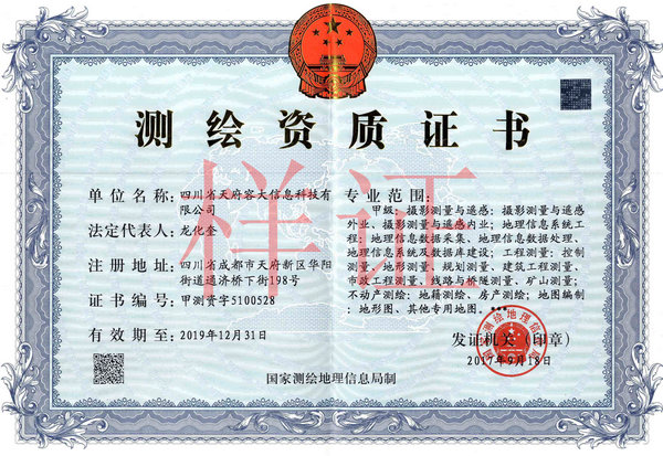
SURVEYING AND MAPPING(CLASS A)
I. Certificate grade and Number
1. Certificate Grade: Class A
2. Certificate Number: JCZ ZI 5100528
II. Professional Scope:
Class A: photogrammetry and remote sensing: field operation of photogrammetry and remote sensing, and office operation of photogrammetry and remote sensing; geography information system engineering: geographic information data acquisition, geographic information data processing, and geographic information system and database construction;
Engineering survey: control survey, topographic survey, planning survey, building engineering survey, municipal engineering survey, line, bridge and tunnel survey, and mine survey;
Real estate surveying and mapping: (1) cadastral surveying and mapping (2) real estate surveying and mapping;
Map preparation: topographic maps, and other special maps. ***
AddTime: 2016-08-10 Views: 63293 Source: SCQD Author: admin